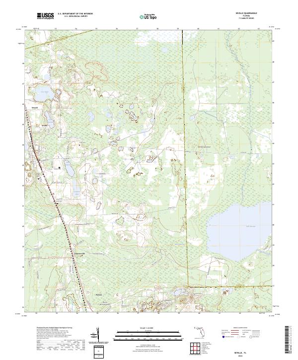
2024 Map of Seville
USGS Topo · Published 2024About this map
Seville and the surrounding citrus-growing region of northwest Volusia County are defined by a mosaic of shallow lakes and cypress-dotted wetlands. This landscape is a significant corridor for local history, featuring several family-named landmarks such as the Causey Family Cem and Roberts Cem. The settlement pattern follows the high ground between water bodies like Lake Juanita and Lake Roberts, with the larger Lake Disston and Saw Grass Bay anchoring the eastern half of the quadrangle.
Find a feature on this map
59 named features on this map. Tap any name to fly to it.
Don’t see what you’re looking for? This feature index may not catch every label — zoom into the map to look around manually.
Map Details
Editions of this 2024 Seville Map
This is the sole edition of this map. No revisions or reprints were ever made.
Other maps of this area

1954 · Daytona Beach
USGS Topo · 1:250,000

1958 · Daytona Beach
USGS Topo · 1:250,000

1964 · Daytona Beach
USGS Topo · 1:250,000

1970 · Crescent City
USGS Topo · 1:24,000

1970 · Welaka SE
USGS Topo · 1:24,000

1970 · Seville
USGS Topo · 1:24,000
1970 · Bunnell
USGS Topo · 1:24,000

1970 · Pierson
USGS Topo · 1:24,000
1971 · Lake Dias
USGS Topo · 1:24,000
1972 · St. Johns Park
USGS Topo · 1:24,000