
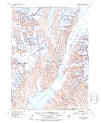
1951 Map of Seward A-6
USGS Topo · Published 1954About this map
The Kenai Mountains dominate this 1951 topographic study, characterized by massive ice fields and the rugged coastline of the Resurrection Peninsula. Two primary ice flows, the Godwin Glacier and Ellsworth Glacier, are depicted with intricate contouring and specific notes on crevasses, illustrating the glaciation that shaped this part of the Chugach National Forest.
Find a feature on this map
12 named features on this map. Tap any name to fly to it.
Don’t see what you’re looking for? This feature index may not catch every label — zoom into the map to look around manually.
Map Details
Editions of this 1951 Seward A-6 Map
2 editions found
Other maps of this area

1946 · Blying Sound
USGS Topo · 1:250,000

1950 · Seward A-6
USGS Topo · 1:63,360

1950 · Blying Sound D-7
USGS Topo · 1:63,360

1950 · Blying Sound D-6
USGS Topo · 1:63,360

1950 · Seward A-7
USGS Topo · 1:63,360

1950 · Blying Sound D-5
USGS Topo · 1:63,360

1951 · Blying Sound
USGS Topo · 1:250,000

1951 · Seward
USGS Topo · 1:250,000

1951 · Seward A-7
USGS Topo · 1:63,360

1951 · Seward B-7
USGS Topo · 1:63,360