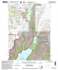
1995 Map of Seward A-6
USGS Topo · Published 1999About this map
The Kenai Mountains dominate this 1995 revision of the Kenai Peninsula, showcasing a landscape defined by glacial activity and protected wilderness. Vast ice fields including Seward Glacier, Godwin Glacier, and Ellsworth Glacier carve through the high terrain, feeding into lower elevations and bodies of water like Bear Glacier Lake. This map records the intersection of the Chugach National Forest and the Alaska Maritime National Wildlife Refuge, illustrating a territory focused on conservation and federal land management. To the south, the deep waters of Day Harbor provide coastal access via Bowen Anchorage and Talus Bay, while the South Fork Snow River drains the northern slopes toward Nellie Juan Lake. This survey is notable for its lack of roads or trails, documenting a purely natural coastal and alpine environment.
Find a feature on this map
17 named features on this map. Tap any name to fly to it.
Don’t see what you’re looking for? This feature index may not catch every label — zoom into the map to look around manually.
Map Details
Editions of this 1995 Seward A-6 Map
This is the sole edition of this map. No revisions or reprints were ever made.
Other maps of this area

1946 · Blying Sound
USGS Topo · 1:250,000

1950 · Seward A-6
USGS Topo · 1:63,360

1950 · Blying Sound D-7
USGS Topo · 1:63,360

1950 · Blying Sound D-6
USGS Topo · 1:63,360

1950 · Seward A-7
USGS Topo · 1:63,360

1950 · Blying Sound D-5
USGS Topo · 1:63,360

1951 · Blying Sound
USGS Topo · 1:250,000

1951 · Seward
USGS Topo · 1:250,000

1951 · Seward A-6
USGS Topo · 1:63,360

1951 · Seward A-7
USGS Topo · 1:63,360