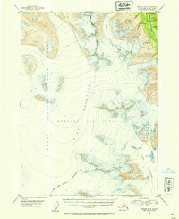
1952 Map of Seward A-8
USGS Topo · Published 1954About this map
The Hardin Icefield dominates the interior of the Kenai Peninsula in this mid-century topographic record, revealing a landscape defined by massive glacial systems and high-altitude terrain. The icefield feeds into several prominent flows, including the deeply fissured Lowell Glacier and the expansive Bear Glacier, where numerous crevasses are documented along the ice margins. To the northeast, the Resurrection River carves through the mountains, joined by tributaries such as Martin Cr and Cottonwood Creek.
Find a feature on this map
14 named features on this map. Tap any name to fly to it.
Don’t see what you’re looking for? This feature index may not catch every label — zoom into the map to look around manually.
Map Details
Editions of this 1952 Seward A-8 Map
This is the sole edition of this map. No revisions or reprints were ever made.
Other maps of this area

1944 · Kenai
USGS Topo · 1:250,000

1946 · Blying Sound
USGS Topo · 1:250,000

1950 · Kenai
USGS Topo · 1:250,000

1950 · Kenai B-1
USGS Topo · 1:63,360

1950 · Seward A-8
USGS Topo · 1:63,360

1950 · Blying Sound D-7
USGS Topo · 1:63,360

1950 · Seward A-7
USGS Topo · 1:63,360

1951 · Blying Sound
USGS Topo · 1:250,000

1951 · Seward
USGS Topo · 1:250,000

1951 · Seldovia
USGS Topo · 1:250,000