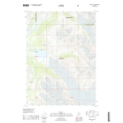
2018 Map of Seward C-6 NE
USGS Topo · Published 2018About this map
The Alaska Central Railroad Tunnel Number 1 sits at the base of a high mountain corridor within the Chugach National Forest, marking a critical passage through the Kenai Peninsula. This 2018 survey detail shows a landscape dominated by massive ice fields and the deep carving of the Placer River Valley. The Placer River flows northward from the meltwaters of the Spencer Glacier, winding through the valley floor toward the boundary between the Kenai Peninsula Borough and the Anchorage Municipality. Hikers and researchers can trace the routes of the Spencer Glacier Trail and the Spencer Bench Trail as they navigate the slopes above the terminal lake. The map also records the positions of the Skookum Glacier, Deadman Glacier, and Bartlett Glacier, providing a clear record of the area's glacial extent and hydrologic network including Skookum Cr.
Find a feature on this map
19 named features on this map. Tap any name to fly to it.
Don’t see what you’re looking for? This feature index may not catch every label — zoom into the map to look around manually.
Map Details
Editions of this 2018 Seward C-6 NE Map
This is the sole edition of this map. No revisions or reprints were ever made.
Other maps of this area

1951 · Seward
USGS Topo · 1:250,000

1951 · Seward C-6
USGS Topo · 1:63,360

1951 · Seward D-5
USGS Topo · 1:63,360

1951 · Seward C-5
USGS Topo · 1:63,360

1951 · Seward D-6
USGS Topo · 1:63,360

1952 · Seward D-5
USGS Topo · 1:63,360

1952 · Seward C-6
USGS Topo · 1:63,360

1952 · Seward D-6
USGS Topo · 1:63,360

1952 · Seward C-5
USGS Topo · 1:63,360

1953 · Seward
USGS Topo · 1:250,000