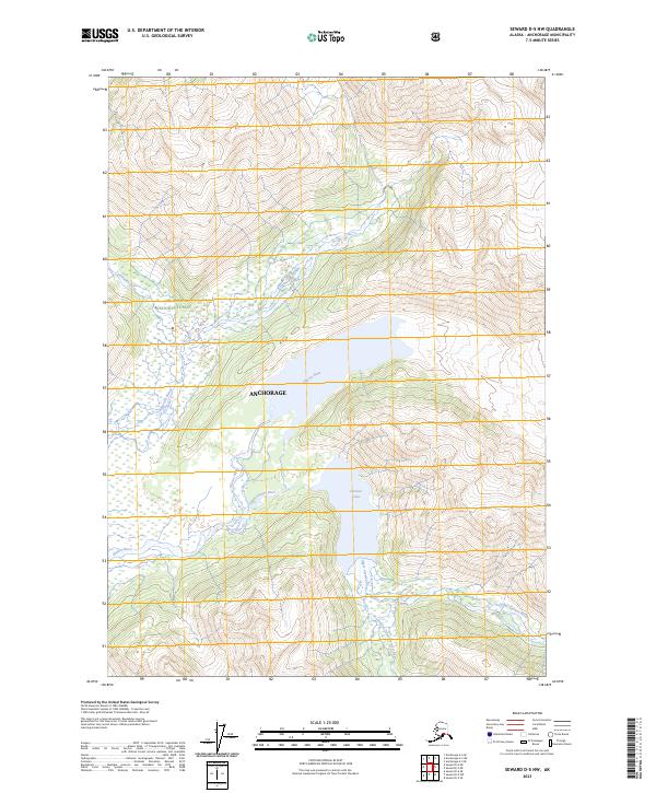
2023 Map of Seward D-5 NW
USGS Topo · Published 2023About this map
Chugach National Forest encompasses this high-altitude Alaskan landscape within the municipality of Anchorage. The map reveals a complex glacial drainage system where the Glacier River and Twentymile River flow through deep valleys shaped by tectonic and glacial forces. Central to the topography is Carmen Lake, fed by the Upper Carmen River and its tributary, the South Fork Upper Carmen River. The intricate contour work illustrates the steep verticality of the Chugach Range, capturing a wilderness where human infrastructure is entirely absent in favor of natural watercourses and undeveloped forest lands. This contemporary survey serves as a vital record of current hydrological patterns and land boundaries within one of the nation’s largest national forests.
Find a feature on this map
13 named features on this map. Tap any name to fly to it.
Don’t see what you’re looking for? This feature index may not catch every label — zoom into the map to look around manually.
Map Details
Editions of this 2023 Seward D-5 NW Map
This is the sole edition of this map. No revisions or reprints were ever made.
Other maps of this area

1951 · Seward
USGS Topo · 1:250,000

1951 · Anchorage
USGS Topo · 1:250,000

1951 · Seward D-5
USGS Topo · 1:63,360

1951 · Seward D-6
USGS Topo · 1:63,360

1952 · Seward D-5
USGS Topo · 1:63,360

1952 · Seward D-6
USGS Topo · 1:63,360

1953 · Seward
USGS Topo · 1:250,000

1959 · Seward
USGS Topo · 1:250,000

1960 · Anchorage A-6
USGS Topo · 1:63,360

1960 · Anchorage A-5
USGS Topo · 1:63,360