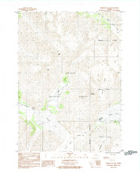
1984 Map of Seward D-5 SW
USGS Topo · Published 1984About this map
Whittier stands at the western edge of Passage Canal, serving as a critical rail and maritime link within the Municipality of Anchorage. This 1984 survey documents the glacial landscape of the Chugach National Forest before significant modern changes to ice coverage. The map illustrates the convergence of major ice flows, including the Portage Glacier, Whittier Glacier, and Learard Glacier, which dominate the local topography alongside peaks like Maynard Mountain.
Find a feature on this map
22 named features on this map. Tap any name to fly to it.
Don’t see what you’re looking for? This feature index may not catch every label — zoom into the map to look around manually.
Map Details
Editions of this 1984 Seward D-5 SW Map
This is the sole edition of this map. No revisions or reprints were ever made.
Other maps of this area

1951 · Seward
USGS Topo · 1:250,000

1951 · Seward C-6
USGS Topo · 1:63,360

1951 · Seward D-5
USGS Topo · 1:63,360

1951 · Seward C-5
USGS Topo · 1:63,360

1951 · Seward D-6
USGS Topo · 1:63,360

1952 · Seward D-5
USGS Topo · 1:63,360

1952 · Seward C-6
USGS Topo · 1:63,360

1952 · Seward D-6
USGS Topo · 1:63,360

1952 · Seward C-5
USGS Topo · 1:63,360

1953 · Seward
USGS Topo · 1:250,000