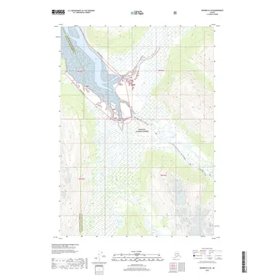
2018 Map of Seward D-6 SE
USGS Topo · Published 2018About this map
The Placer River Valley serves as a central corridor for transportation and glacial drainage through the Chugach National Forest in this 2018 survey. The landscape is defined by the convergence of major waterways, including the Twentymile River, Placer River, and Portage Creek, which flow into the north end of the Pacific Ocean inlet. The Seward Highway and the Portage Glacier Road provide the primary access through this complex terrain of wetlands and glacial outflow. Detailed mountain features like Explorer Glacier and the seasonal Iditarod National Historic Trail (INHT) routes illustrate the intersection of modern recreation and historical transit paths. Small inland water bodies such as Luebner Lake, Airstrip Pond, and Alder Pond dot the marshy lowlands, providing specific landmarks for those navigating the valley floor between the high ridges of the Anchorage Municipality and Kenai Peninsula Borough.
Find a feature on this map
23 named features on this map. Tap any name to fly to it.
Don’t see what you’re looking for? This feature index may not catch every label — zoom into the map to look around manually.
Map Details
Editions of this 2018 Seward D-6 SE Map
This is the sole edition of this map. No revisions or reprints were ever made.
Other maps of this area

1951 · Seward
USGS Topo · 1:250,000

1951 · Seward C-6
USGS Topo · 1:63,360

1951 · Seward D-5
USGS Topo · 1:63,360

1951 · Seward C-5
USGS Topo · 1:63,360

1951 · Seward D-6
USGS Topo · 1:63,360

1952 · Seward D-5
USGS Topo · 1:63,360

1952 · Seward C-6
USGS Topo · 1:63,360

1952 · Seward D-6
USGS Topo · 1:63,360

1952 · Seward C-5
USGS Topo · 1:63,360

1953 · Seward
USGS Topo · 1:250,000