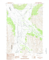
1984 Map of Seward D-6 SE
USGS Topo · Published 1984About this map
Turnagain Arm dominates the northwestern edge of this 1980s survey, where the glacial waters meet a landscape defined by the Placer River Valley and the Twentymile River. The settlement of Portage serves as a critical junction point at the head of the arm, marking the transition from the tidal flats to the interior mountain passes. To the south, the Explorer Glacier carves through the high terrain of the Chugach National Forest, feeding into Portage Creek. The map provides a detailed view of the infrastructure and natural drainage patterns of this transit corridor during the mid-1980s, including the smaller waters of Luebner Lake and Skookum Creek that dot the valley floor. This area represents a vital geographic link between the Municipality of Anchorage and the Kenai Peninsula Borough.
Find a feature on this map
12 named features on this map. Tap any name to fly to it.
Don’t see what you’re looking for? This feature index may not catch every label — zoom into the map to look around manually.
Map Details
Editions of this 1984 Seward D-6 SE Map
This is the sole edition of this map. No revisions or reprints were ever made.
Other maps of this area

1951 · Seward
USGS Topo · 1:250,000

1951 · Seward C-6
USGS Topo · 1:63,360

1951 · Seward D-5
USGS Topo · 1:63,360

1951 · Seward C-5
USGS Topo · 1:63,360

1951 · Seward D-6
USGS Topo · 1:63,360

1952 · Seward D-5
USGS Topo · 1:63,360

1952 · Seward C-6
USGS Topo · 1:63,360

1952 · Seward D-6
USGS Topo · 1:63,360

1952 · Seward C-5
USGS Topo · 1:63,360

1953 · Seward
USGS Topo · 1:250,000