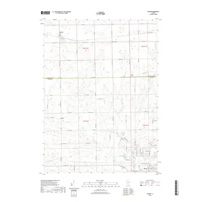
2018 Map of Seward
USGS Topo · Published 2018About this map
Seward serves as a focal point in the northern section of this Illinois landscape, where the intersection of Tracy St and Grant St marks the village's small-town grid. To the south, the settlement of Byron occupies the lower right quadrant, showing a more developed network of streets including W Blackhawk Dr and W Second St. The terrain is defined by the drainage systems of Grove Cr, Middle Cr, and the several branches of Mill Cr, which carve through the farmland between Winnebago and Ogle counties. Cultural landmarks like the Middle Creek Cem and the Po in Byron provide specific points of interest for those tracing local lineages or community centers. The map also identifies the unincorporated community of Myrtle, positioned along the junction of W Myrtle RD and N Pecatonica Rd.
Find a feature on this map
48 named features on this map. Tap any name to fly to it.
Don’t see what you’re looking for? This feature index may not catch every label — zoom into the map to look around manually.
Map Details
Editions of this 2018 Seward Map
This is the sole edition of this map. No revisions or reprints were ever made.
Other maps of this area

1917 · Kings
USGS Topo · 1:62,500

1918 · Rockford
USGS Topo · 1:62,500

1918 · Kings
USGS Topo · 1:62,500

1922 · Oregon
USGS Topo · 1:62,500

1924 · Oregon
USGS Topo · 1:62,500

1932 · Pecatonica
USGS Topo · 1:62,500

1936 · Pecatonica
USGS Topo · 1:62,500

1938 · Rockford
USGS Topo · 1:62,500

1954 · Rockford
USGS Topo · 1:250,000

1955 · Rockford
USGS Topo · 1:250,000