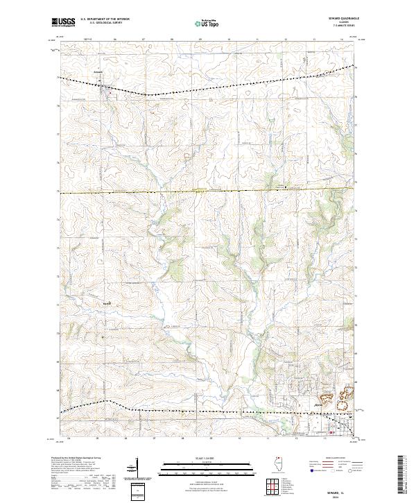
2024 Map of Seward
USGS Topo · Published 2024About this map
Seward sits at the northern edge of this Illinois landscape, defined by the rural transition between Winnebago and Ogle counties. The area is heavily intersected by a network of local roads such as S Pecatonica Rd and W Montague Rd, which connect the small settlements of Myrtle and the northern outskirts of Byron. The physical geography is shaped by the winding paths of Mill Creek and Middle Creek, which carve through the farmland to the south and east. Historic local sites, including the Middle Creek Cem and Byron Cem, provide grounded points of reference for genealogical research. The presence of a Po in Seward indicates the town's role as a local service hub for the surrounding agricultural community.
Find a feature on this map
82 named features on this map. Tap any name to fly to it.
Don’t see what you’re looking for? This feature index may not catch every label — zoom into the map to look around manually.
Map Details
Editions of this 2024 Seward Map
This is the sole edition of this map. No revisions or reprints were ever made.
Other maps of this area

1917 · Kings
USGS Topo · 1:62,500

1918 · Rockford
USGS Topo · 1:62,500

1918 · Kings
USGS Topo · 1:62,500

1922 · Oregon
USGS Topo · 1:62,500

1924 · Oregon
USGS Topo · 1:62,500

1932 · Pecatonica
USGS Topo · 1:62,500

1936 · Pecatonica
USGS Topo · 1:62,500

1938 · Rockford
USGS Topo · 1:62,500

1954 · Rockford
USGS Topo · 1:250,000

1955 · Rockford
USGS Topo · 1:250,000