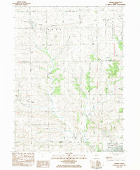
1983 Map of Seward
USGS Topo · Published 1984About this map
Seward and Myrtle sit within a landscape defined by the winding waters of the Leaf River and its numerous tributaries in the early 1980s. This survey captures the rural character of Northern Illinois, where the Chicago Milwaukee St Paul and Pacific railroad cuts through the southern terrain near Byron. The map provides a detailed view of local community landmarks, including several educational and religious sites such as the Mary Morgan Sch and the Middle Creek Ch. A complex network of drainage is visible, with Grope Creek, Mill Fork, and Oak Grove Creek carving through the agricultural land. Evidence of local industry is present in several locations, specifically identified as a Quarry and a Gravel Pit, indicating the extraction of geological resources that supported the area's development and infrastructure.
Find a feature on this map
47 named features on this map. Tap any name to fly to it.
Don’t see what you’re looking for? This feature index may not catch every label — zoom into the map to look around manually.
Map Details
Editions of this 1983 Seward Map
This is the sole edition of this map. No revisions or reprints were ever made.
Other maps of this area

1917 · Kings
USGS Topo · 1:62,500

1918 · Rockford
USGS Topo · 1:62,500

1918 · Kings
USGS Topo · 1:62,500

1922 · Oregon
USGS Topo · 1:62,500

1924 · Oregon
USGS Topo · 1:62,500

1932 · Pecatonica
USGS Topo · 1:62,500

1936 · Pecatonica
USGS Topo · 1:62,500

1938 · Rockford
USGS Topo · 1:62,500

1954 · Rockford
USGS Topo · 1:250,000

1955 · Rockford
USGS Topo · 1:250,000