
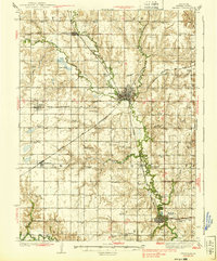
1939 Map of Seward
USGS Topo · Published 1939About this map
Big Blue River and Lincoln Creek converge at Seward, anchoring a landscape defined by Nebraska's agricultural and rail development in the mid-1930s. The region is heavily marked by a dense network of country schools, such as School No 70 and the Lake View Sch, which served the scattered farmsteads of the Great Plains. The Chicago and Northwestern and Chicago Burlington and Quincy railroads intersect here, facilitating the movement of grain and goods from towns like Staplehurst and Tamora. This survey provides a precise record of early 20th-century rural infrastructure, including numerous family-named and community burial grounds like Berry Mound Cem and the Mennonite Cem near Milford. The presence of institutions like the Industrial Home and specialized schools like St Johns Sch reflects the social and educational fabric of a growing Seward County.
Find a feature on this map
65 named features on this map. Tap any name to fly to it.
Don’t see what you’re looking for? This feature index may not catch every label — zoom into the map to look around manually.
Map Details
Editions of this 1939 Seward Map
3 editions found
Other maps of this area

1897 · Lincoln
USGS Topo · 1:125,000

1899 · Wahoo
USGS Topo · 1:125,000

1899 · David City
USGS Topo · 1:125,000

1934 · Seward
USGS Topo · 1:48,000

1934 · Utica
USGS Topo · 1:62,500

1935 · Dorchester
USGS Topo · 1:48,000

1937 · Utica
USGS Topo · 1:62,500

1940 · Dorchester
USGS Topo · 1:62,500

1955 · Fremont
USGS Topo · 1:250,000

1955 · Lincoln
USGS Topo · 1:250,000