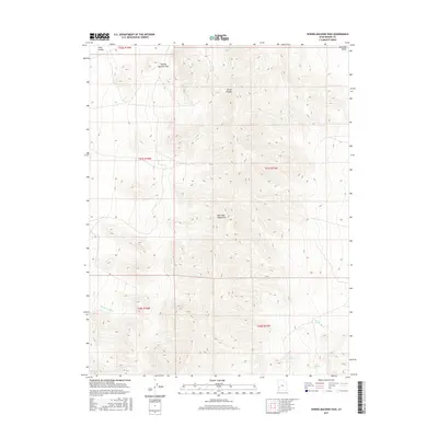
2017 Map of Sewing Machine Pass
USGS Topo · Published 2017About this map
Wah Wah Mountains dominate this high-desert landscape in Beaver County, providing a stark topographical divide between Pine Valley to the west and the Wah Wah Valley to the east. This 2017 topographic study highlights the critical importance of water management and natural springs in an arid environment, where localized features like Kiln Spring and Gun Spring represent vital resources. The presence of Blackburn Ditch in the southwest suggests a history of water diversion for agricultural or livestock purposes, while the aptly named The Mudhole marks a low collection point in the basin floor. Sewing Machine Pass serves as a primary transit point through the mountain range, connecting these two expansive valleys. The grid of the Public Land Survey System, including townships like t27s r15w, overlays the complex terrain of Corral Canyon, illustrating the modern management of these public lands.
Find a feature on this map
14 named features on this map. Tap any name to fly to it.
Don’t see what you’re looking for? This feature index may not catch every label — zoom into the map to look around manually.
Map Details
Editions of this 2017 Sewing Machine Pass Map
This is the sole edition of this map. No revisions or reprints were ever made.
Other maps of this area

1953 · Richfield
USGS Topo · 1:250,000

1958 · Richfield
USGS Topo · 1:250,000

1959 · Frisco
USGS Topo · 1:62,500

1960 · Frisco Peak
USGS Topo · 1:62,500

1960 · Wah Wah Summit
USGS Topo · 1:62,500

1971 · Pine Grove Reservoir
USGS Topo · 1:24,000

1971 · Sewing Machine Pass
USGS Topo · 1:24,000

1971 · Lamerdorf Peak NW
USGS Topo · 1:24,000

1971 · Lamerdorf Peak
USGS Topo · 1:24,000

1980 · Wah Wah Mts. South
USGS Topo · 1:100,000