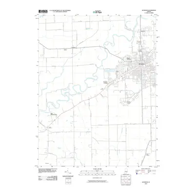
2010 Map of Seymour
USGS Topo · Published 2010About this map
The city of Seymour serves as the focal point of this Jackson County study, where a dense grid of streets meets the meandering course of the East Fork White River. To the southwest, the expansive grounds of Freeman Municipal Airport occupy a significant footprint, representing the area's mid-century aviation infrastructure. The landscape is defined by the tension between the structured urban layout and the fluid natural path of the river, which is joined by tributaries like Indian Creek and Heddy Run.
Find a feature on this map
53 named features on this map. Tap any name to fly to it.
Don’t see what you’re looking for? This feature index may not catch every label — zoom into the map to look around manually.
Map Details
Editions of this 2010 Seymour Map
This is the sole edition of this map. No revisions or reprints were ever made.
Other maps of this area

1942 · Franklin
USGS Topo · 1:125,000

1942 · Columbus
USGS Topo · 1:125,000

1948 · Waymansville
USGS Topo · 1:24,000

1953 · Cincinnati
USGS Topo · 1:250,000

1953 · Indianapolis
USGS Topo · 1:250,000

1956 · Indianapolis
USGS Topo · 1:250,000

1956 · Vincennes
USGS Topo · 1:250,000

1956 · Louisville
USGS Topo · 1:250,000

1957 · Indianapolis
USGS Topo · 1:250,000

1957 · Vincennes
USGS Topo · 1:250,000