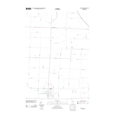
2013 Map of Seymour
USGS Topo · Published 2013About this map
Seymour serves as the primary municipal hub in this northern Outagamie County landscape, where the intersection of Wi-55 and local routes like W Factory St define the town's grid. The surrounding geography is heavily shaped by the drainage patterns of the Black Cr and its tributaries, including Toad Cr, which wind through the agricultural tracts. To the north, the small crossroads of Rose Lawn and Isaar mark the shift toward more rural territory near the W Br Suamico River and S Br Suamico River. The 2013 survey illustrates a transition from the established residential streets of Seymour to an expansive network of rural lanes, including the uniquely named Chicken Aly. These secondary roads, such as Vandenheuvel Rd and Linsmeyer Rd, provide a window into the land divisions and family-named routes that have defined this farming community for generations.
Find a feature on this map
65 named features on this map. Tap any name to fly to it.
Don’t see what you’re looking for? This feature index may not catch every label — zoom into the map to look around manually.
Map Details
Editions of this 2013 Seymour Map
This is the sole edition of this map. No revisions or reprints were ever made.
Other maps of this area

1954 · De Pere
USGS Topo · 1:62,500

1954 · Green Bay
USGS Topo · 1:62,500

1955 · Appleton
USGS Topo · 1:62,500

1955 · Seymour
USGS Topo · 1:62,500

1955 · Green Bay
USGS Topo · 1:250,000

1974 · Seymour
USGS Topo · 1:24,000

1974 · Zachow
USGS Topo · 1:24,000
1974 · Bonduel
USGS Topo · 1:24,000
1974 · Nichols
USGS Topo · 1:24,000
1974 · Oneida South
USGS Topo · 1:24,000