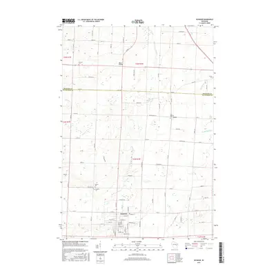
2016 Map of Seymour
USGS Topo · Published 2016About this map
Seymour serves as the primary hub of this landscape, situated at the southern edge of the survey area where a grid of residential streets and local landmarks congregate. The geography transition north into the small communities of Rose Lawn and Isaar, characterized by their association with local parishes and burial grounds like Saint Sebastian Cem. The drainage pattern is defined by the winding course of Black Cr and the headwaters of the W Br Suamico River, which provide natural boundaries across the flat Wisconsin terrain.
Find a feature on this map
84 named features on this map. Tap any name to fly to it.
Don’t see what you’re looking for? This feature index may not catch every label — zoom into the map to look around manually.
Map Details
Editions of this 2016 Seymour Map
This is the sole edition of this map. No revisions or reprints were ever made.
Other maps of this area

1954 · De Pere
USGS Topo · 1:62,500

1954 · Green Bay
USGS Topo · 1:62,500

1955 · Appleton
USGS Topo · 1:62,500

1955 · Seymour
USGS Topo · 1:62,500

1955 · Green Bay
USGS Topo · 1:250,000

1974 · Seymour
USGS Topo · 1:24,000

1974 · Zachow
USGS Topo · 1:24,000
1974 · Bonduel
USGS Topo · 1:24,000
1974 · Nichols
USGS Topo · 1:24,000
1974 · Oneida South
USGS Topo · 1:24,000