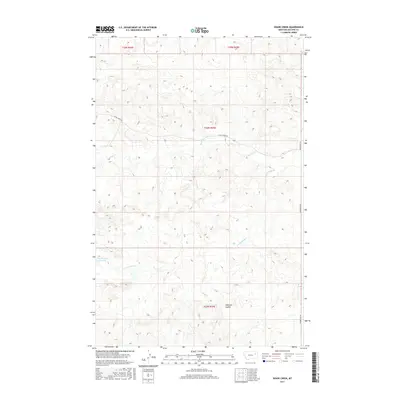
2017 Map of Shade Creek
USGS Topo · Published 2017About this map
Shade Creek Rd and Prairie Elk Rd anchor the limited transportation network of this eastern Montana landscape, illustrating the remote nature of McCone County in the early 21st century. The drainage patterns of Shade Cr and its tributary, S Fork Shade Cr, define the topography, cutting through the high plains toward larger basins. A notable point of human intervention is found at Christianson Reservoir, a vital water resource in an otherwise arid environment. Evidence of local ranching and land use is further indicated by named terrain features like Williams Coulee and the seasonal path of Ruff Cr, which highlight the importance of specific topography for navigation and livestock in this open range.
Find a feature on this map
11 named features on this map. Tap any name to fly to it.
Don’t see what you’re looking for? This feature index may not catch every label — zoom into the map to look around manually.
Map Details
Editions of this 2017 Shade Creek Map
This is the sole edition of this map. No revisions or reprints were ever made.
Other maps of this area

1954 · Jordan
USGS Topo · 1:250,000

1954 · Glendive
USGS Topo · 1:250,000

1956 · Jordan
USGS Topo · 1:250,000

1957 · Glendive
USGS Topo · 1:250,000

1958 · Jordan
USGS Topo · 1:250,000

1958 · Glendive
USGS Topo · 1:250,000

1964 · Jordan
USGS Topo · 1:250,000

1973 · Crow Springs
USGS Topo · 1:24,000
1973 · Willis Buttes
USGS Topo · 1:24,000
1973 · Pasture Creek
USGS Topo · 1:24,000