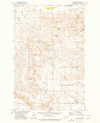
1973 Map of Pasture Creek
USGS Topo · Published 1977About this map
The Missouri River defines the northern edge of this drainage-rich landscape in McCone County, surveyed as part of the Department of the Interior program for the Missouri River Basin. The terrain is characterized by a dense network of seasonal watercourses and coulees, including Hungry Creek, Pasture Creek, and Remuda Creek. Evidence of early 1970s land management and remote ranching infrastructure is visible at the Deadman Dam and a central Landing Strip, reflecting the logistical realities of this isolated Montana cattle-country environment.
Find a feature on this map
27 named features on this map. Tap any name to fly to it.
Don’t see what you’re looking for? This feature index may not catch every label — zoom into the map to look around manually.
Map Details
Editions of this 1973 Pasture Creek Map
This is the sole edition of this map. No revisions or reprints were ever made.
Other maps of this area

1915 · Frazer
USGS Topo · 1:62,500

1915 · Oswego
USGS Topo · 1:62,500

1954 · Jordan
USGS Topo · 1:250,000

1954 · Glendive
USGS Topo · 1:250,000

1954 · Wolf Point
USGS Topo · 1:250,000

1954 · Glasgow
USGS Topo · 1:250,000

1956 · Jordan
USGS Topo · 1:250,000

1957 · Glasgow
USGS Topo · 1:250,000

1957 · Glendive
USGS Topo · 1:250,000

1958 · Wolf Point
USGS Topo · 1:250,000