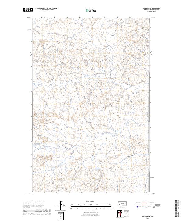
2024 Map of Shade Creek
USGS Topo · Published 2024About this map
Shade Creek Rd and Prairie Elk Rd trace the winding drainage patterns of this McCone County landscape, where the seasonal flow of Shade Creek meets its southern tributaries. The terrain is defined by a dense network of coulees and draws, most notably Williams Coulee in the southeast. Water management is central to this rangeland, evidenced by the Christianson Reservoir positioned along the South Fork Shade Creek. The map documents a sparsely populated area characterized by traditional township and range divisions, where ephemeral water sources like Ruff Creek dictate the local geography. This 2024 survey provides a clear view of the modern road network and hydrologic features as they exist today in this part of eastern Montana.
Find a feature on this map
12 named features on this map. Tap any name to fly to it.
Don’t see what you’re looking for? This feature index may not catch every label — zoom into the map to look around manually.
Map Details
Editions of this 2024 Shade Creek Map
This is the sole edition of this map. No revisions or reprints were ever made.
Other maps of this area

1954 · Jordan
USGS Topo · 1:250,000

1954 · Glendive
USGS Topo · 1:250,000

1956 · Jordan
USGS Topo · 1:250,000

1957 · Glendive
USGS Topo · 1:250,000

1958 · Jordan
USGS Topo · 1:250,000

1958 · Glendive
USGS Topo · 1:250,000

1964 · Jordan
USGS Topo · 1:250,000

1973 · Crow Springs
USGS Topo · 1:24,000
1973 · Willis Buttes
USGS Topo · 1:24,000
1973 · Pasture Creek
USGS Topo · 1:24,000