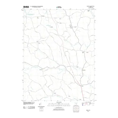
2010 Map of Shade
USGS Topo · Published 2010About this map
Shade sits near the heart of this landscape where the Middle Branch Shade River and Pratts Fork carve through southeastern Ohio. The map documents a rural community structure defined by its crossroads and family-held land, evidenced by the numerous burial grounds like Burson Cemetery, Jerseyville Cemetery, and Jeffers Cemetery that dot the hillsides. The Shade Post Office serves as a central landmark for a network of winding township and county roads that connect outlying settlements such as Pleasanton, Chase, and Snowville.
Find a feature on this map
80 named features on this map. Tap any name to fly to it.
Don’t see what you’re looking for? This feature index may not catch every label — zoom into the map to look around manually.
Map Details
Editions of this 2010 Shade Map
This is the sole edition of this map. No revisions or reprints were ever made.
Other maps of this area

1903 · Athens
USGS Topo · 1:62,500

1904 · Chesterhill
USGS Topo · 1:62,500

1905 · Athens
USGS Topo · 1:62,500

1906 · Chesterhill
USGS Topo · 1:62,500

1907 · Pomeroy
USGS Topo · 1:62,500

1907 · Keno
USGS Topo · 1:62,500

1947 · Columbus
USGS Topo · 1:250,000

1949 · Clarksburg
USGS Topo · 1:250,000

1956 · Clarksburg
USGS Topo · 1:250,000

1960 · Albany
USGS Topo · 1:24,000