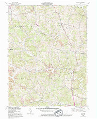
1992 Map of Shade
USGS Topo · Published 1995About this map
The Middle Branch Shade River and its numerous tributaries, including Pratts Fork and Kingsbury Creek, define the complex drainage patterns of this rural landscape spanning the Athens and Meigs County border. Small, dispersed settlements like Shade, Pleasanton, and Snowville are connected by a network of ridge-running roads such as Gilrey Ridge Road and Helwig Ridge Road. The local topography is characterized by the distinct townships of Alexander, Lodi, Scipio, and Bedford.
Find a feature on this map
40 named features on this map. Tap any name to fly to it.
Don’t see what you’re looking for? This feature index may not catch every label — zoom into the map to look around manually.
Map Details
Editions of this 1992 Shade Map
This is the sole edition of this map. No revisions or reprints were ever made.
Other maps of this area

1903 · Athens
USGS Topo · 1:62,500

1904 · Chesterhill
USGS Topo · 1:62,500

1905 · Athens
USGS Topo · 1:62,500

1906 · Chesterhill
USGS Topo · 1:62,500

1907 · Pomeroy
USGS Topo · 1:62,500

1907 · Keno
USGS Topo · 1:62,500

1947 · Columbus
USGS Topo · 1:250,000

1949 · Clarksburg
USGS Topo · 1:250,000

1956 · Clarksburg
USGS Topo · 1:250,000

1960 · Albany
USGS Topo · 1:24,000