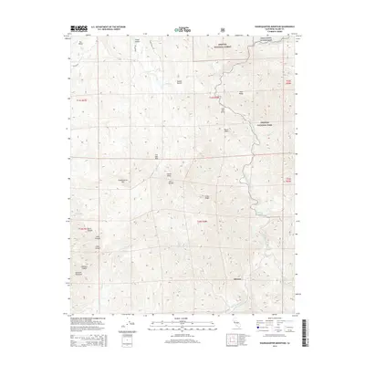
2015 Map of Shadequarter Mountain
USGS Topo · Published 2015About this map
Advance and Tarbell Pocket sit within a landscape dominated by the foothills of the Sierra Nevada, where steep canyons and high ridges define the terrain. The meeting point of the Sequoia National Forest, Kings Canyon National Park, and Sequoia National Park creates a complex boundary system across the high country. Natural drainage patterns are anchored by the N Fork Kaweah River and Eshom Creek, which carve deep passages such as Lion Canyon and Clark Canyon. Named landmarks like Becketts Backbone and Shadequarter Mtn indicate the verticality of the region, while the Eshom Valley provides a rare pocket of flatter ground. Historically significant access points like Live Oak Pass and the winding Eshom Valley Dr connect these remote settlements to the broader Tulare County geography.
Find a feature on this map
39 named features on this map. Tap any name to fly to it.
Don’t see what you’re looking for? This feature index may not catch every label — zoom into the map to look around manually.
Map Details
Editions of this 2015 Shadequarter Mountain Map
This is the sole edition of this map. No revisions or reprints were ever made.
Other maps of this area

1903 · Tehipite
USGS Topo · 1:125,000

1904 · Kaweah
USGS Topo · 1:125,000

1905 · Tehipite
USGS Topo · 1:125,000

1909 · Kaweah
USGS Topo · 1:125,000

1922 · Trimmer
USGS Topo · 1:96,000

1924 · Dinuba
USGS Topo · 1:125,000

1928 · Lemon Cove
USGS Topo · 1:31,680

1937 · Kaweah
USGS Topo · 1:125,000

1942 · Dunlap
USGS Topo · 1:62,500

1944 · Dunlap
USGS Topo · 1:62,500