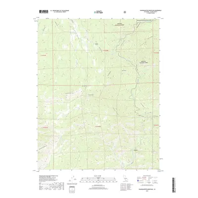
2018 Map of Shadequarter Mountain
USGS Topo · Published 2018About this map
Sequoia National Park, Sequoia National Forest, and Kings Canyon National Park converge in this high-altitude landscape of Tulare County. The terrain is defined by dramatic elevations, from the peaks of Shadequarter Mtn and Becketts Backbone to the deep incisions of Redwood Canyon and Live Oak Gulch. This 2018 survey captures the interface of protected wilderness and rugged backcountry infrastructure.
Find a feature on this map
37 named features on this map. Tap any name to fly to it.
Don’t see what you’re looking for? This feature index may not catch every label — zoom into the map to look around manually.
Map Details
Editions of this 2018 Shadequarter Mountain Map
This is the sole edition of this map. No revisions or reprints were ever made.
Other maps of this area

1903 · Tehipite
USGS Topo · 1:125,000

1904 · Kaweah
USGS Topo · 1:125,000

1905 · Tehipite
USGS Topo · 1:125,000

1909 · Kaweah
USGS Topo · 1:125,000

1922 · Trimmer
USGS Topo · 1:96,000

1924 · Dinuba
USGS Topo · 1:125,000

1928 · Lemon Cove
USGS Topo · 1:31,680

1937 · Kaweah
USGS Topo · 1:125,000

1942 · Dunlap
USGS Topo · 1:62,500

1944 · Dunlap
USGS Topo · 1:62,500