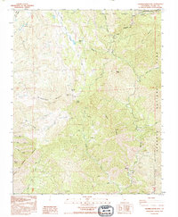
1993 Map of Shadequarter Mtn
USGS Topo · Published 1995About this map
Shadequarter Mountain dominates this high-altitude landscape where the western slopes of the Sierra Nevada meet established federal preserves. This 1993 provisional survey documents a transition zone between the managed Sequoia National Forest and the protected wilderness of Sequoia National Park. Historically significant landmarks include the Shadequarter Lookout perched above the Eshom Valley drainage and the Advance Ruins located near the North Fork Kaweah River. The terrain is defined by steep drainages like Sheep Creek and Cedar Creek, while numerous Corral notations and 4WD tracks suggest a legacy of ranching and forestry activity. The map reveals the intricate network of water sources, from the East Fork to isolated Springs and named pockets like Tarbell Pocket, that supported early mountain life and resource extraction.
Find a feature on this map
36 named features on this map. Tap any name to fly to it.
Don’t see what you’re looking for? This feature index may not catch every label — zoom into the map to look around manually.
Map Details
Editions of this 1993 Shadequarter Mtn Map
This is the sole edition of this map. No revisions or reprints were ever made.
Other maps of this area

1903 · Tehipite
USGS Topo · 1:125,000

1904 · Kaweah
USGS Topo · 1:125,000

1905 · Tehipite
USGS Topo · 1:125,000

1909 · Kaweah
USGS Topo · 1:125,000

1922 · Trimmer
USGS Topo · 1:96,000

1924 · Dinuba
USGS Topo · 1:125,000

1928 · Lemon Cove
USGS Topo · 1:31,680

1937 · Kaweah
USGS Topo · 1:125,000

1942 · Dunlap
USGS Topo · 1:62,500

1944 · Dunlap
USGS Topo · 1:62,500