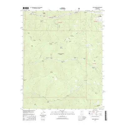
2017 Map of Shady Brook
USGS Topo · Published 2017About this map
Rio Fernando de Taos winds through the high-altitude terrain of the Carson National Forest, anchoring a landscape defined by deep canyons and mountain ridges. The settlements of Shady Brook and Valle Escondido are positioned along the northern boundary, while the southern reaches of the map are characterized by the complex drainage systems of the Santa Fe Mountains and the Rincon Mountains. This 2017 survey documents a high-country environment where names like Sierra de Don Fernando and the Sangre de Cristo Mountains indicate the deep-rooted cultural heritage of northern New Mexico. The map illustrates a network of seasonal water sources and clearings such as Osha Park and Paradise Park, alongside significant geological transitions through Chosa Pass. Numerous canyons named for local families, including Mondragon Canyon and Sanchez Canyon, provide insight into the historical land use and grazing patterns of this high-elevation region.
Find a feature on this map
53 named features on this map. Tap any name to fly to it.
Don’t see what you’re looking for? This feature index may not catch every label — zoom into the map to look around manually.
Map Details
Editions of this 2017 Shady Brook Map
This is the sole edition of this map. No revisions or reprints were ever made.
Other maps of this area

1954 · Raton
USGS Topo · 1:250,000

1958 · Raton
USGS Topo · 1:250,000

1964 · Taos
USGS Topo · 1:24,000

1964 · Tres Ritos
USGS Topo · 1:24,000

1964 · Ranchos De Taos
USGS Topo · 1:24,000

1965 · Osha Mountain
USGS Topo · 1:24,000

1965 · Chacon
USGS Topo · 1:24,000

1965 · Palo Flechado Pass
USGS Topo · 1:24,000

1965 · Pueblo Peak
USGS Topo · 1:24,000

1965 · Shady Brook
USGS Topo · 1:24,000