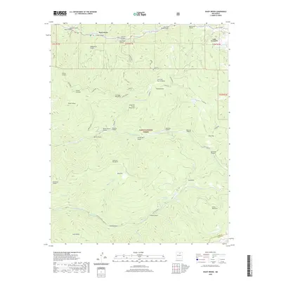
2020 Map of Shady Brook
USGS Topo · Published 2020About this map
Valle Escondido and the small settlement of Shady Brook are the primary residential anchors in this mountainous reach of the Carson National Forest. The landscape is defined by the high ridges of the Sangre de Cristo Mountains and the Fernando Mountains, where a complex network of canyons like Shady Brook Canyon and Mondragon Canyon drain toward the Rio Fernando de Taos. Historically, this area has been shaped by its difficult terrain and the critical water sources that sustain the high mountain meadows, including Bernardin Lake and Porky Spring. Numerous named trails such as Buena Suerte, Paradise, and Mondragon traverse the Santa Fe Mountains, illustrating the long-standing importance of backcountry access for forest management and high-altitude recreation in Taos County.
Find a feature on this map
57 named features on this map. Tap any name to fly to it.
Don’t see what you’re looking for? This feature index may not catch every label — zoom into the map to look around manually.
Map Details
Editions of this 2020 Shady Brook Map
This is the sole edition of this map. No revisions or reprints were ever made.
Other maps of this area

1954 · Raton
USGS Topo · 1:250,000

1958 · Raton
USGS Topo · 1:250,000

1964 · Taos
USGS Topo · 1:24,000

1964 · Tres Ritos
USGS Topo · 1:24,000

1964 · Ranchos De Taos
USGS Topo · 1:24,000

1965 · Osha Mountain
USGS Topo · 1:24,000

1965 · Chacon
USGS Topo · 1:24,000

1965 · Palo Flechado Pass
USGS Topo · 1:24,000

1965 · Pueblo Peak
USGS Topo · 1:24,000

1965 · Shady Brook
USGS Topo · 1:24,000