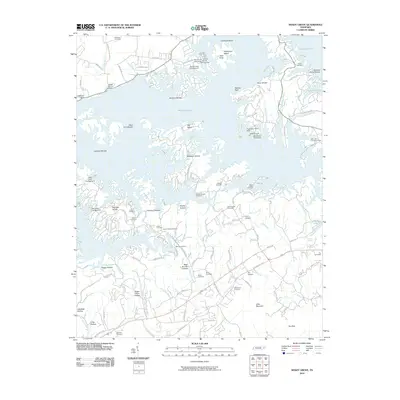
2010 Map of Shady Grove
USGS Topo · Published 2010About this map
Douglas Lake dominates the northern half of this landscape, its intricate shoreline creating numerous inlets and points such as Inspiration Point and Henderson Island. The map reflects a region where water recreation and residential growth coexist with deep-rooted rural foundations. Along the southern corridor, the Old Newport Hwy links the community of Fair Garden to the surrounding hills. This area is characterized by a dense distribution of family and community cemeteries, including the Hills Union Cemetery, Stafford Cemetery, and Swann Cemetery, indicating long-standing genealogical ties to the land. The topography is defined by a series of hollows like Patterson Hollow and Boat Gunnel Hollow, while the drainage network of Hettie Creek and Flat Creek flows toward the lake. Navigation and access are highlighted by several landings and docks, such as Shady Grove Dock and Mountain View Dock, serving the various campgrounds and waterfront developments.
Find a feature on this map
107 named features on this map. Tap any name to fly to it.
Don’t see what you’re looking for? This feature index may not catch every label — zoom into the map to look around manually.
Map Details
Editions of this 2010 Shady Grove Map
This is the sole edition of this map. No revisions or reprints were ever made.
Other maps of this area

1883 · Morristown
USGS Topo · 1:125,000

1886 · Knoxville
USGS Topo · 1:125,000

1892 · Knoxville
USGS Topo · 1:125,000

1893 · Mt Guyot
USGS Topo · 1:125,000

1893 · Morristown
USGS Topo · 1:125,000

1894 · Knoxville
USGS Topo · 1:125,000

1895 · Morristown
USGS Topo · 1:125,000

1895 · Knoxville
USGS Topo · 1:125,000

1897 · Maynardville
USGS Topo · 1:125,000

1900 · Maynardville
USGS Topo · 1:125,000