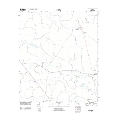
2012 Map of Shady Grove
USGS Topo · Published 2012About this map
Shady Grove and the winding Econfina River anchor this Taylor County landscape, where small crossroads communities and family landmarks define the rural geography. The river snakes through the southern half of the quadrangle, crossed at its lower reach by the Pete Gibson Bridge. To the north and west, the terrain is marked by established settlements like Eridu, Iddo, and Sirmans, connected by a network of local roads including Morris Steen Rd and Bobby King Rd.
Find a feature on this map
56 named features on this map. Tap any name to fly to it.
Don’t see what you’re looking for? This feature index may not catch every label — zoom into the map to look around manually.
Map Details
Editions of this 2012 Shady Grove Map
This is the sole edition of this map. No revisions or reprints were ever made.
Other maps of this area

1952 · Secotan
USGS Topo · 1:24,000

1954 · Johnson Hammock
USGS Topo · 1:24,000

1954 · Boyd
USGS Topo · 1:24,000

1954 · Secotan
USGS Topo · 1:24,000

1954 · Greenville
USGS Topo · 1:24,000

1954 · Greenville NE
USGS Topo · 1:24,000

1954 · Valdosta
USGS Topo · 1:250,000

1955 · Lamont
USGS Topo · 1:24,000

1955 · Shady Grove
USGS Topo · 1:24,000

1955 · Lamont SE
USGS Topo · 1:24,000