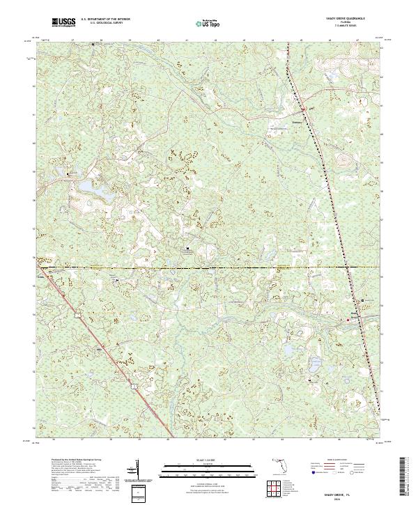
2024 Map of Shady Grove
USGS Topo · Published 2024About this map
Shady Grove and the surrounding rural landscape of Madison and Taylor Counties appear here in contemporary detail, characterized by a complex network of wetlands and pine flatwoods. The course of the Econfina River winds through the lower portion of the sheet, while Alligator Creek traverses the northern reaches, defining the local drainage patterns. This area is punctuated by small, established communities such as Eridu, Iddo, Sirmans, and Ebb, which are connected by a web of local roads and named connectors like Alton Wentworth.
Find a feature on this map
86 named features on this map. Tap any name to fly to it.
Don’t see what you’re looking for? This feature index may not catch every label — zoom into the map to look around manually.
Map Details
Editions of this 2024 Shady Grove Map
This is the sole edition of this map. No revisions or reprints were ever made.
Other maps of this area

1952 · Secotan
USGS Topo · 1:24,000

1954 · Johnson Hammock
USGS Topo · 1:24,000

1954 · Boyd
USGS Topo · 1:24,000

1954 · Secotan
USGS Topo · 1:24,000

1954 · Greenville
USGS Topo · 1:24,000

1954 · Greenville NE
USGS Topo · 1:24,000

1954 · Valdosta
USGS Topo · 1:250,000

1955 · Lamont
USGS Topo · 1:24,000

1955 · Shady Grove
USGS Topo · 1:24,000

1955 · Lamont SE
USGS Topo · 1:24,000