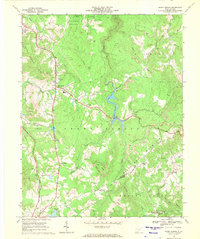
1968 Map of Shady Spring
USGS Topo · Published 1971About this map
Shady Spring Mountain and Rich Mountain define the topography of this Raleigh County region in the late 1960s, a landscape shaped by coal extraction and growing recreation. Industrial activity is concentrated in the numerous strip mines that dot the ridges, particularly along Squealing Pt and Joes Ridge. In contrast, the development of Flat Top Lake and Little Beaver State Park reflects a shift toward leisure, anchored by the Golf Course near Shady Grove Ch.
Find a feature on this map
53 named features on this map. Tap any name to fly to it.
Don’t see what you’re looking for? This feature index may not catch every label — zoom into the map to look around manually.
Map Details
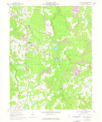
Editions of this 1968 Shady Spring Map
2 editions found
Other maps of this area

1887 · Hinton
USGS Topo · 1:125,000

1891 · Raleigh
USGS Topo · 1:125,000

1892 · Hinton
USGS Topo · 1:125,000

1897 · Raleigh
USGS Topo · 1:125,000

1902 · Raleigh
USGS Topo · 1:125,000

1911 · Flattop
USGS Topo · 1:48,000

1911 · Beckley
USGS Topo · 1:48,000

1912 · Meadow Creek
USGS Topo · 1:48,000

1912 · Big Bend
USGS Topo · 1:62,500

1913 · Beckley
USGS Topo · 1:62,500