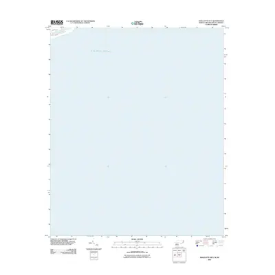
2011 Map of Shallotte OE S
USGS Topo · Published 2011About this map
The Atlantic Ocean dominates this coastal survey, which captures the shifting shoreline where the Carolinas meet the sea. The map depicts a small portion of the residential grid at the edge of the mainland, including N Shore Dr, E Main St, and Canal Dr. Most of the sheet is a record of open water, providing a precise spatial reference for the maritime boundary and the coastal interface in Brunswick County during the early 21st century. The alignment of these streets against the Atlantic provides a clear document of the local topography and developed footprint before further coastal changes occurred.
Find a feature on this map
4 named features on this map. Tap any name to fly to it.
Don’t see what you’re looking for? This feature index may not catch every label — zoom into the map to look around manually.
Map Details
Editions of this 2011 Shallotte OE S Map
This is the sole edition of this map. No revisions or reprints were ever made.
Other maps of this area

1943 · Little River
USGS Topo · 1:31,680

1943 · Calabash
USGS Topo · 1:31,680

1943 · Holden Beach
USGS Topo · 1:24,000

1943 · Shallotte
USGS Topo · 1:24,000

1944 · Shallotte
USGS Topo · 1:31,680

1949 · Georgetown
USGS Topo · 1:250,000
1950 · Shallotte
USGS Topo · 1:25,000
1953 · Little River
USGS Topo · 1:24,000
1953 · Calabash
USGS Topo · 1:24,000

1967 · Georgetown
USGS Topo · 1:250,000