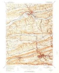
1952 Map of Shamokin
USGS Topo · Published 1954About this map
The Susquehanna River curves dramatically through this mid-century landscape, separating the industrial and institutional hub of Danville from the southern anthracite coal region. In Danville, the massive footprint of the Geisinger Hospital and the nearby State Hospital underscore the town's role as a regional center, while the Pennsylvania Canal (Abandoned) traces the northern riverbank as a relic of earlier commerce.
Find a feature on this map
157 named features on this map. Tap any name to fly to it.
Don’t see what you’re looking for? This feature index may not catch every label — zoom into the map to look around manually.
Map Details
Editions of this 1952 Shamokin Map
3 editions found

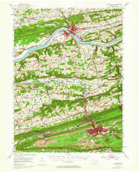
Other maps of this area

1889 · Catawissa
USGS Topo · 1:62,500

1892 · Catawissa
USGS Topo · 1:62,500

1892 · Lykens
USGS Topo · 1:62,500

1892 · Shamokin
USGS Topo · 1:62,500

1892 · Pine Grove
USGS Topo · 1:62,500

1893 · Sunbury
USGS Topo · 1:62,500

1893 · Lykens
USGS Topo · 1:62,500

1893 · Shamokin
USGS Topo · 1:62,500

1893 · Millersburg
USGS Topo · 1:62,500

1894 · Catawissa
USGS Topo · 1:62,500