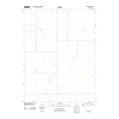
2010 Map of Shamrock
USGS Topo · Published 2010About this map
Sand Arroyo Creek and its various branches, including the West Fork Sand Arroyo Creek, define the drainage patterns of this high plains landscape at the start of the twenty-first century. The area around Shamrock is characterized by a precise rectilinear road grid, reflecting the systematic land division of eastern Colorado. This network includes local thoroughfares such as Shamrock Mile Rd, Hard Money Mile Rd, and Paperbirch Rd, which facilitate movement across the sparse terrain. Water management is a central feature of the local geography, represented by the presence of Simpsons Reservoir and Hoffman Creek. These water bodies and the accompanying drainage ways are the primary landmarks in an otherwise open agricultural or ranching environment, illustrating the critical role of water resources in the development of the region.
Find a feature on this map
16 named features on this map. Tap any name to fly to it.
Don’t see what you’re looking for? This feature index may not catch every label — zoom into the map to look around manually.
Map Details
Editions of this 2010 Shamrock Map
This is the sole edition of this map. No revisions or reprints were ever made.
Other maps of this area

1954 · Limon
USGS Topo · 1:250,000

1954 · Sterling
USGS Topo · 1:250,000

1957 · Limon
USGS Topo · 1:250,000

1958 · Limon
USGS Topo · 1:250,000

1958 · Sterling
USGS Topo · 1:250,000

1963 · Adena
USGS Topo · 1:24,000

1965 · Vallery SE
USGS Topo · 1:24,000

1965 · Huey Ranch
USGS Topo · 1:24,000
1973 · Potty Brown Creek
USGS Topo · 1:24,000

1973 · Shamrock
USGS Topo · 1:24,000