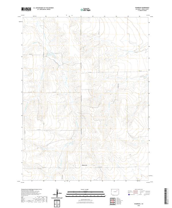
2022 Map of Shamrock
USGS Topo · Published 2022About this map
Shamrock serves as the primary named point on this high-plains landscape in eastern Adams County. The terrain is defined by the drainage patterns of Sand Arroyo Creek and its various tributaries, including W Fork San Arroyo Cr and Hoffman Cr, which carve through the undulating topography. In an area where water management is critical to the agricultural and ranching lifestyle, Simpsons Reservoir stands out as a key landmark in the northern portion of the quadrangle.
Find a feature on this map
22 named features on this map. Tap any name to fly to it.
Don’t see what you’re looking for? This feature index may not catch every label — zoom into the map to look around manually.
Map Details
Editions of this 2022 Shamrock Map
This is the sole edition of this map. No revisions or reprints were ever made.
Other maps of this area

1954 · Limon
USGS Topo · 1:250,000

1954 · Sterling
USGS Topo · 1:250,000

1957 · Limon
USGS Topo · 1:250,000

1958 · Limon
USGS Topo · 1:250,000

1958 · Sterling
USGS Topo · 1:250,000

1963 · Adena
USGS Topo · 1:24,000

1965 · Vallery SE
USGS Topo · 1:24,000

1965 · Huey Ranch
USGS Topo · 1:24,000
1973 · Potty Brown Creek
USGS Topo · 1:24,000

1973 · Shamrock
USGS Topo · 1:24,000