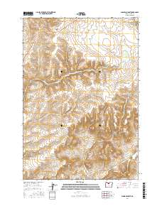
2017 Map of Shaniko Summit
USGS Topo · Published 2017About this map
Shaniko anchors the northeastern corner of this Wasco County landscape, where the high plateaus begin their descent through a series of dramatic canyon systems. The terrain is defined by significant elevation changes, from the prominent Shaniko Summit down into the carved depths of Chain Canyon and Deep Canyon. This area of north-central Oregon showcases a complex drainage network including Ward Cr and Indian Cr, which cut through the volcanic geology typical of the region. The map reveals how early transit relied on these natural corridors, with modern routes often following the same paths past landmarks like Courthouse Rock and the somberly named Deadman Canyon. Researchers can trace the intersection of old land survey boundaries, such as t7s r16e, across a landscape where water features like Mary McKinley Draw were vital for the high-desert cattle and sheep ranching that once centered on the nearby railhead.
Find a feature on this map
23 named features on this map. Tap any name to fly to it.
Don’t see what you’re looking for? This feature index may not catch every label — zoom into the map to look around manually.
Map Details
Editions of this 2017 Shaniko Summit Map
This is the sole edition of this map. No revisions or reprints were ever made.
Other maps of this area

1953 · The Dalles
USGS Topo · 1:250,000

1955 · Bend
USGS Topo · 1:250,000

1956 · The Dalles
USGS Topo · 1:250,000

1957 · Bend
USGS Topo · 1:250,000

1957 · The Dalles
USGS Topo · 1:250,000

1958 · Bend
USGS Topo · 1:250,000

1966 · Antelope
USGS Topo · 1:62,500

1966 · Willowdale
USGS Topo · 1:62,500

1970 · Macken Canyon
USGS Topo · 1:24,000
1971 · Criterion
USGS Topo · 1:24,000