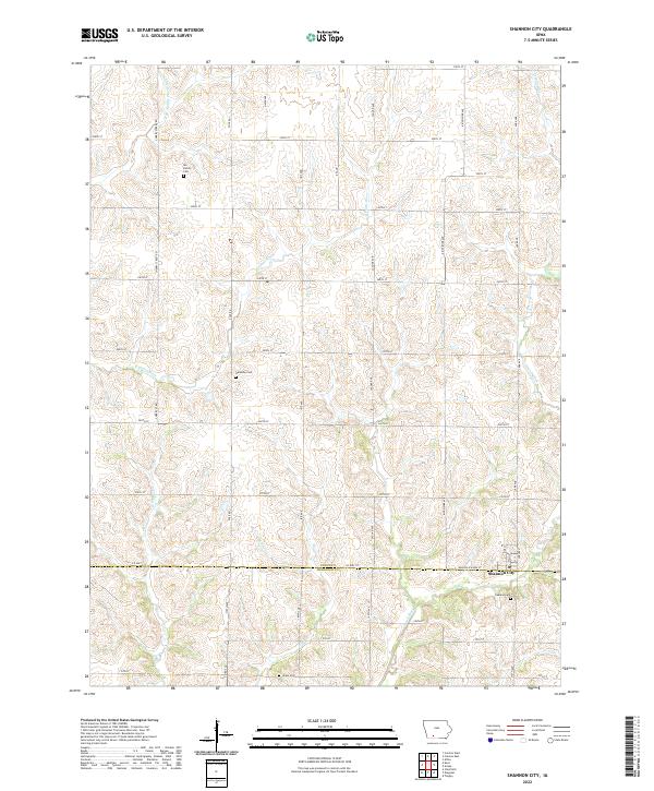
2022 Map of Shannon City
USGS Topo · Published 2022About this map
Shannon City sits at the southern edge of Union County, positioned along the border with Ringgold County. This agricultural landscape is defined by the branching tributaries of the Platte and Grand Rivers, which carve through the terrain between a regular grid of section roads. The map reveals a high concentration of burial sites that speak to the long-standing community roots in the area, including Oakland Cem just outside the town limits, and the smaller Ide Family Cem to the northwest. These cemeteries, alongside Harmony Cem and Union Cem, serve as primary markers of local heritage in a region where the natural flow of the E Platte River and the Grand River has dictated the placement of farms and homesteads for generations. The road network, primarily composed of numeric avenues and streets like 220th St and 180th Ave, connects these rural sites to the local center at Shannon City.
Find a feature on this map
47 named features on this map. Tap any name to fly to it.
Don’t see what you’re looking for? This feature index may not catch every label — zoom into the map to look around manually.
Map Details
Editions of this 2022 Shannon City Map
This is the sole edition of this map. No revisions or reprints were ever made.
Other maps of this area

1951 · Afton
USGS Topo · 1:62,500

1954 · Omaha
USGS Topo · 1:250,000

1955 · Nebraska City
USGS Topo · 1:250,000

1957 · Nebraska City
USGS Topo · 1:250,000

1957 · Omaha
USGS Topo · 1:250,000

1958 · Omaha
USGS Topo · 1:250,000

1958 · Nebraska City
USGS Topo · 1:250,000

1980 · Creston East
USGS Topo · 1:24,000
1981 · Creston West
USGS Topo · 1:24,000
1981 · Arispe
USGS Topo · 1:24,000