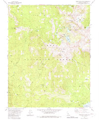
1982 Map of Sharktooth Peak
USGS Topo · Published 1982About this map
Sharktooth Peak and the high ridges of the Silver Divide dominate this high-altitude landscape within the John Muir Wilderness. In the early 1980s, this section of the Sierra National Forest was characterized by a dense network of glacial lakes and alpine meadows. The southern edge of the map features the northern reach of Lake Thomas A Edison, where the Vermilion Campground served as a base for backcountry travelers. Numerous meadows such as Onion Spring Meadow, Tule Meadow, and Fawn Meadow are scattered throughout the drainage basins of Silver Creek and the South Fork San Joaquin River. Traces of earlier resource exploration are visible via a noted Prospect near Pincushion Peak, while the varied terrain includes distinctive landmarks like the Cockscomb, Arch Rock, and Saddle Mtn. The map also captures several primitive campsites along Rock Creek Lake and the Margaret Lakes chain.
Find a feature on this map
50 named features on this map. Tap any name to fly to it.
Don’t see what you’re looking for? This feature index may not catch every label — zoom into the map to look around manually.
Map Details
Editions of this 1982 Sharktooth Peak Map
2 editions found
Other maps of this area

1901 · Mt. Lyell
USGS Topo · 1:125,000

1904 · Kaiser
USGS Topo · 1:125,000

1912 · Mt. Goddard
USGS Topo · 1:125,000

1914 · Mt. Morrison
USGS Topo · 1:125,000

1947 · Mariposa
USGS Topo · 1:250,000

1948 · Mariposa
USGS Topo · 1:250,000

1953 · Mt. Morrison
USGS Topo · 1:62,500

1953 · Mt Abbot
USGS Topo · 1:62,500

1953 · Devils Postpile
USGS Topo · 1:62,500

1953 · Kaiser Peak
USGS Topo · 1:62,500