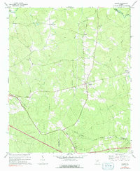
1972 Map of Sharon
USGS Topo · Published 1991About this map
Sharon serves as a central hub in this pocket of Georgia, where several rural road networks converge alongside the Georgia RR railroad line. The landscape is deeply carved by water, defined by the northern boundary of the Little River and numerous drainages like Harden Creek and Kindrick Creek that flow through the undulating terrain. Small rural settlements and crossroads such as Barnett, Raytown, and Sandy Cross are scattered throughout, each anchored by local landmarks like Mt Olive Ch, Level Hill Ch, and Jennings Ch.
Find a feature on this map
24 named features on this map. Tap any name to fly to it.
Don’t see what you’re looking for? This feature index may not catch every label — zoom into the map to look around manually.
Map Details
Editions of this 1972 Sharon Map
2 editions found
Other maps of this area

1906 · Crawfordville
USGS Topo · 1:125,000

1953 · Athens
USGS Topo · 1:250,000

1958 · Athens
USGS Topo · 1:250,000

1959 · Athens
USGS Topo · 1:250,000

1963 · Athens
USGS Topo · 1:250,000

1966 · Philomath
USGS Topo · 1:24,000

1966 · Crawfordville
USGS Topo · 1:24,000

1972 · Sharon
USGS Topo · 1:24,000

1972 · Sparta NW
USGS Topo · 1:24,000
1972 · Cadley
USGS Topo · 1:24,000