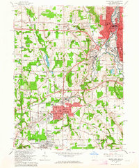
1962 Map of Sharon West
USGS Topo · Published 1964About this map
The Sharon and Farrell industrial corridor along the Shenango River anchors this 1962 study of the Ohio and Pennsylvania borderlands. The landscape transitions from the dense urban grids of Hubbard and Youngstown to the semi-rural patches of Trumbull County, marked by significant infrastructure including the New York Central and Erie-Lackawanna railroads. Notable local landmarks such as Petroleum and Coalburg reflect the region's extraction-based heritage, while the U S Military Reservation and numerous country clubs like Yankee Run indicate a post-war shift in land use. For genealogists, the map preserves the exact locations of parochial institutions like St Patricks School and several burial grounds, including Maple Grove Cemetery and Mt Hope Park Cemetery.
Find a feature on this map
56 named features on this map. Tap any name to fly to it.
Don’t see what you’re looking for? This feature index may not catch every label — zoom into the map to look around manually.
Map Details
Editions of this 1962 Sharon West Map
4 editions found
Other maps of this area

1905 · Neshannock
USGS Topo · 1:62,500

1906 · Youngstown
USGS Topo · 1:62,500

1907 · Neshannock
USGS Topo · 1:62,500

1907 · Kinsman
USGS Topo · 1:62,500

1908 · Shenango
USGS Topo · 1:62,500

1908 · Youngstown
USGS Topo · 1:62,500

1950 · Cleveland
USGS Topo · 1:250,000

1951 · Campbell
USGS Topo · 1:24,000

1951 · Youngstown
USGS Topo · 1:24,000

1954 · Sharon West
USGS Topo · 1:24,000