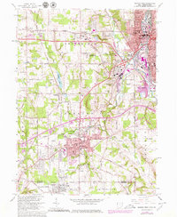
1962 Map of Sharon West
USGS Topo · Published 1979About this map
The industrial corridor of the Mahoning Valley and the Ohio-Pennsylvania state line anchor this landscape, where the heavy rail infrastructure of Conrail connects the manufacturing hubs of Sharon, Farrell, and Hubbard. This mid-century survey captures the region's dense urban development alongside remnants of its earlier rural character, such as Paynes Corner and Brookfield Station. Significant social and civic anchors are well-documented, particularly the clustered Catholic institutions of St Patricks Sch, St Patricks Ch, and St Patricks Cem in Hubbard. The terrain is shaped by the drainage of Yankee Run and the artificial Coalburg Lake, while the presence of a U S Military Reservation near Salow Corners reflects the era's strategic land use. From the residential neighborhoods of Yankee Hills to the northern edge of Youngstown, the map provides a look at the infrastructure of the postwar American rust belt.
Find a feature on this map
61 named features on this map. Tap any name to fly to it.
Don’t see what you’re looking for? This feature index may not catch every label — zoom into the map to look around manually.
Map Details
Editions of this 1962 Sharon West Map
4 editions found
Other maps of this area

1905 · Neshannock
USGS Topo · 1:62,500

1906 · Youngstown
USGS Topo · 1:62,500

1907 · Neshannock
USGS Topo · 1:62,500

1907 · Kinsman
USGS Topo · 1:62,500

1908 · Shenango
USGS Topo · 1:62,500

1908 · Youngstown
USGS Topo · 1:62,500

1950 · Cleveland
USGS Topo · 1:250,000

1951 · Campbell
USGS Topo · 1:24,000

1951 · Youngstown
USGS Topo · 1:24,000

1954 · Sharon West
USGS Topo · 1:24,000