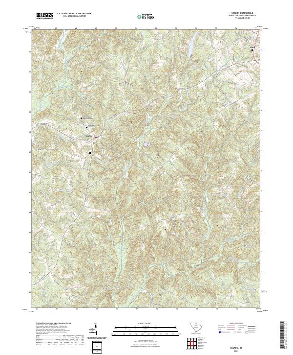
2024 Map of Sharon
USGS Topo · Published 2024About this map
Sharon and the surrounding York County countryside are defined by a complex network of waterways and ridges. The terrain is marked by significant drainages including Turkey Creek, Bullock Creek, and the aptly named Purgatory Branch, with Turkey Creek Ridge rising between the local watersheds. For those researching family history in the area, the map meticulously documents several key burial sites and congregations, such as the Saint John Baptist Church Graveyard, Woodlawn Presbyterian Church Cem, and the Sharon Church Graveyard. In the northeastern corner, the edge of York appears, featuring the Union Cem. The landscape is interlaced with secondary roads and family-named routes like McGill Rd, Shillinglaw Rd, and Clark Steele Rd, which trace the established paths between these rural South Carolina settlements and their neighboring agricultural lands.
Find a feature on this map
81 named features on this map. Tap any name to fly to it.
Don’t see what you’re looking for? This feature index may not catch every label — zoom into the map to look around manually.
Map Details
Editions of this 2024 Sharon Map
This is the sole edition of this map. No revisions or reprints were ever made.
Other maps of this area

1906 · Kings Mountain
USGS Topo · 1:62,500

1907 · Sharon
USGS Topo · 1:62,500

1908 · Kings Mountain
USGS Topo · 1:62,500

1941 · Spartanburg
USGS Topo · 1:250,000

1947 · Clover
USGS Topo · 1:62,500

1949 · Clover
USGS Topo · 1:62,500

1949 · Rock Hill
USGS Topo · 1:62,500

1953 · Spartanburg
USGS Topo · 1:250,000

1953 · Charlotte
USGS Topo · 1:250,000

1954 · Charlotte
USGS Topo · 1:250,000