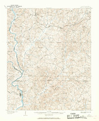
1907 Map of Sharon
USGS Topo · Published 1969About this map
Broad River and the Pacolet River define the western boundaries of this early twentieth-century survey, where the river economy was still reliant on traditional crossings like Howells Ferry, Pinckney Ferry, and Thompson Ferry. The landscape is dotted with rural church congregations that served as community anchors, including Unity Church, Wilson Chapel, and Armenia Church.
Find a feature on this map
67 named features on this map. Tap any name to fly to it.
Don’t see what you’re looking for? This feature index may not catch every label — zoom into the map to look around manually.
Map Details
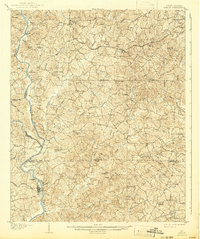
Editions of this 1907 Sharon Map
3 editions found
Other maps of this area

1906 · Kings Mountain
USGS Topo · 1:62,500

1907 · Sharon
USGS Topo · 1:62,500

1908 · Kings Mountain
USGS Topo · 1:62,500

1909 · Gaffney
USGS Topo · 1:62,500

1941 · Spartanburg
USGS Topo · 1:250,000

1947 · Clover
USGS Topo · 1:62,500

1949 · Clover
USGS Topo · 1:62,500
1949 · Rock Hill
USGS Topo · 1:62,500

1953 · Spartanburg
USGS Topo · 1:250,000

1953 · Charlotte
USGS Topo · 1:250,000