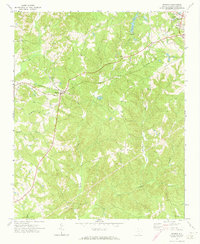
1972 Map of Sharon
USGS Topo · Published 1973About this map
Sharon serves as the central hub of this York County landscape, where the Southern railroad line intersects with local trade routes. The surrounding countryside is defined by a dense network of watercourses, most notably Turkey Creek and its many tributaries like Dry Fork Turkey Creek and McClures Branch. These streams carve through the terrain, separating small rural communities marked by their local congregations. Several country churches, including Mt Carmel Ch and St Johns Ch, appear alongside family-history landmarks like Union Cem. To the northeast, the outskirts of York show signs of municipal development with a Filtration Plant and Sewage Disposal facility. This survey documents a traditional South Carolina Piedmont landscape during a period of steady growth, maintaining its rural character through established homesteads and the presence of a Lookout Tower monitoring the wooded tracts.
Find a feature on this map
31 named features on this map. Tap any name to fly to it.
Don’t see what you’re looking for? This feature index may not catch every label — zoom into the map to look around manually.
Map Details
Editions of this 1972 Sharon Map
This is the sole edition of this map. No revisions or reprints were ever made.
Other maps of this area

1906 · Kings Mountain
USGS Topo · 1:62,500

1907 · Sharon
USGS Topo · 1:62,500

1908 · Kings Mountain
USGS Topo · 1:62,500

1941 · Spartanburg
USGS Topo · 1:250,000

1947 · Clover
USGS Topo · 1:62,500

1949 · Clover
USGS Topo · 1:62,500

1949 · Rock Hill
USGS Topo · 1:62,500

1953 · Spartanburg
USGS Topo · 1:250,000

1953 · Charlotte
USGS Topo · 1:250,000

1954 · Charlotte
USGS Topo · 1:250,000