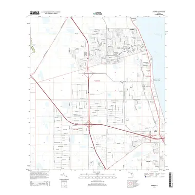
2015 Map of Sharpes
USGS Topo · Published 2015About this map
Indian River Lagoon and the Intracoastal Waterway dominate the eastern margin of this coastal landscape, illustrating the critical water-and-rail corridor that shaped Brevard County's development. Residential expansion is evident in the dense street grids of Port Saint John and Canaveral Acres, while smaller, established communities like Frontenac, Sharpes, and Delespine anchor the transition toward Cocoa in the south. The transportation network is defined by the north-south transit of the Florida East Coast railroad and major arteries such as the Challenger Memorial Pky and Grisson Pky. Educational and environmental markers including the Brevard Community Coll campus and interior water bodies like Lake Wilson and Sharpes Lake provide specific reference points for local history researchers tracing the modernization of this Atlantic shoreline region.
Find a feature on this map
31 named features on this map. Tap any name to fly to it.
Don’t see what you’re looking for? This feature index may not catch every label — zoom into the map to look around manually.
Map Details
Editions of this 2015 Sharpes Map
This is the sole edition of this map. No revisions or reprints were ever made.
Other maps of this area

1949 · Orsino
USGS Topo · 1:24,000

1949 · Titusville
USGS Topo · 1:24,000

1949 · Courtenay
USGS Topo · 1:24,000

1949 · Sharpes
USGS Topo · 1:24,000

1949 · Cocoa
USGS Topo · 1:24,000

1951 · Cocoa
USGS Topo · 1:24,000

1951 · Courtenay
USGS Topo · 1:24,000

1951 · Sharpes
USGS Topo · 1:24,000

1951 · Orsino
USGS Topo · 1:24,000

1952 · Titusville
USGS Topo · 1:24,000