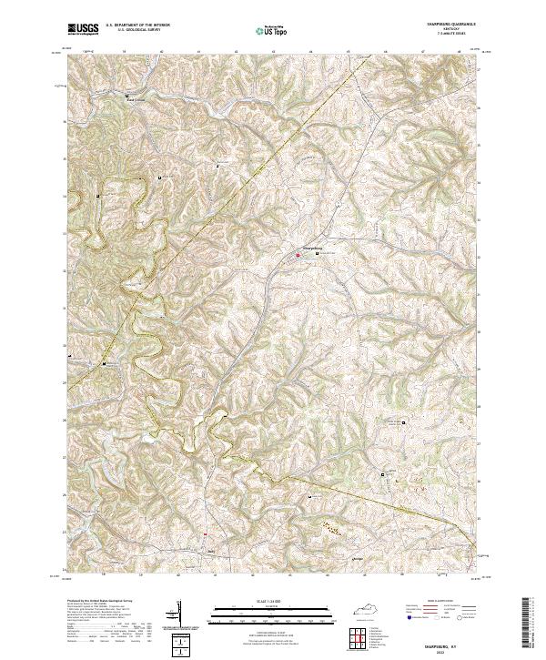
2022 Map of Sharpsburg
USGS Topo · Published 2022About this map
Sharpsburg serves as a central hub in this modern topographic study of the Bluegrass region, where the borders of Bath, Nicholas, Montgomery, and Bourbon counties converge. The landscape is defined by the winding course of Hinkston Creek and its many tributaries, including Peytons Lick Br and Bald Eagle Cr. This area maintains a strong connection to its pioneer and agrarian roots, evidenced by the high density of family and community burial grounds such as Crown Hill Cem, Bramlett Cem, and Jewell Cem.
Find a feature on this map
76 named features on this map. Tap any name to fly to it.
Don’t see what you’re looking for? This feature index may not catch every label — zoom into the map to look around manually.
Map Details
Editions of this 2022 Sharpsburg Map
This is the sole edition of this map. No revisions or reprints were ever made.
Other maps of this area

1952 · Preston
USGS Topo · 1:24,000

1952 · Owingsville
USGS Topo · 1:24,000

1952 · Sharpsburg
USGS Topo · 1:24,000

1952 · Mount Sterling
USGS Topo · 1:24,000

1952 · Sherburne
USGS Topo · 1:24,000

1952 · North Middletown
USGS Topo · 1:24,000
1952 · Sideview
USGS Topo · 1:24,000

1953 · Carlisle
USGS Topo · 1:24,000

1953 · Moorefield
USGS Topo · 1:24,000

1956 · Louisville
USGS Topo · 1:250,000