
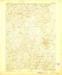
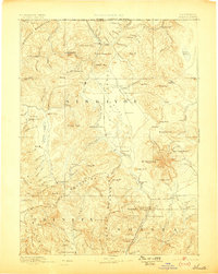
1886 Map of Shasta
USGS Topo · Published 1886About this map
Mt Shasta dominates this 1880s landscape, serving as a massive topographical anchor for the surrounding valleys and settlements. In the northern reaches, the mining and administrative hub of Yreka sits near the confluence of Yreka Creek and the Shasta Valley, while smaller mining camps like Mugginsville and Oro Fino are tucked into the western canyons of the Scott Valley. This era of development is defined by an extraction-based economy, evidenced by the Altoona Mines and Empire Mill, and a reliance on river crossings such as the ferry at Henley.
Find a feature on this map
118 named features on this map. Tap any name to fly to it.
Don’t see what you’re looking for? This feature index may not catch every label — zoom into the map to look around manually.
Map Details
Editions of this 1886 Shasta Map
3 editions found
Other maps of this area

1886 · Lassen Peak
USGS Topo · 1:250,000

1886 · Modoc Lava Bed
USGS Topo · 1:250,000

1889 · Klamath
USGS Topo · 1:250,000

1890 · Red Bluff
USGS Topo · 1:250,000

1891 · Ashland
USGS Topo · 1:250,000

1892 · Modoc Lava-Bed
USGS Topo · 1:250,000

1892 · Lassen Peak
USGS Topo · 1:250,000

1893 · Ashland
USGS Topo · 1:250,000

1894 · Lassen Peak
USGS Topo · 1:250,000

1894 · Klamath
USGS Topo · 1:250,000