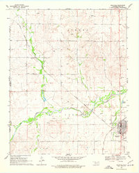
1969 Map of Shattuck
USGS Topo · Published 1977About this map
Shattuck serves as the focal point of this Ellis County survey, where the Atchison Topeka and Santa Fe railroad corridor dictates the regional orientation. The landscape is defined by the convergence of several waterways, including Wolf Creek, Ivanhoe Creek, and Six Pony Creek, which carve through the plains. The map captures a mid-century community infrastructure featuring the Shattuck Airport, a Drive-in Theater, and the local Faith Ch.
Find a feature on this map
28 named features on this map. Tap any name to fly to it.
Don’t see what you’re looking for? This feature index may not catch every label — zoom into the map to look around manually.
Map Details
Editions of this 1969 Shattuck Map
2 editions found
Other maps of this area

1954 · Perryton
USGS Topo · 1:250,000

1955 · Woodward
USGS Topo · 1:250,000

1958 · Perryton
USGS Topo · 1:250,000

1958 · Woodward
USGS Topo · 1:250,000

1969 · Shattuck
USGS Topo · 1:24,000

1969 · Shattuck NW
USGS Topo · 1:24,000

1969 · Gage
USGS Topo · 1:24,000

1969 · Shattuck NE
USGS Topo · 1:24,000

1970 · Arnett
USGS Topo · 1:24,000

1970 · Goodwin
USGS Topo · 1:24,000