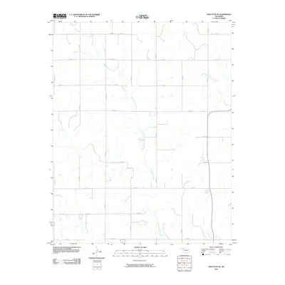
2010 Map of Shattuck NE
USGS Topo · Published 2010About this map
Twentyfive Mile Creek meanders diagonally across this corner of Ellis County, defining the drainage patterns for a series of section-line roads. This portion of the Oklahoma Panhandle fringe illustrates the rigid Jeffersonian grid system, where local travel relies on a network of numbered routes such as N1770 Rd and E0380 Rd. The landscape is dominated by these seasonal watercourses, including Sixteenmile Creek in the northeast, which carve subtle relief into the High Plains. While largely agricultural, the map detail captures the specific placement of rural homesteads and access points along thoroughfares like N1820 Rd and E0440 Rd, providing a clear record of land division and infrastructure in the early twenty-first century.
Find a feature on this map
18 named features on this map. Tap any name to fly to it.
Don’t see what you’re looking for? This feature index may not catch every label — zoom into the map to look around manually.
Map Details
Editions of this 2010 Shattuck NE Map
This is the sole edition of this map. No revisions or reprints were ever made.
Other maps of this area

1955 · Woodward
USGS Topo · 1:250,000

1958 · Woodward
USGS Topo · 1:250,000

1969 · Fargo SW
USGS Topo · 1:24,000

1969 · Fargo NW
USGS Topo · 1:24,000

1969 · Shattuck
USGS Topo · 1:24,000

1969 · Shattuck NW
USGS Topo · 1:24,000

1969 · Gage
USGS Topo · 1:24,000

1969 · Shattuck NE
USGS Topo · 1:24,000

1970 · Laverne SW
USGS Topo · 1:24,000

1971 · May East
USGS Topo · 1:24,000