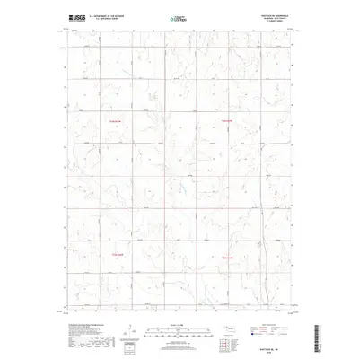
2018 Map of Shattuck NE
USGS Topo · Published 2018About this map
Twentyfive Mile Cr and Sixteenmile Cr carve a network of drainage patterns across this Ellis County landscape, defining the topography of the High Plains near the Oklahoma-Texas border. This 2018 edition reveals a highly structured environment organized by the Public Land Survey System, with gravel and dirt roads such as N1770 Rd and E0360 Rd following precise section lines. The map captures the intersection of four townships, including t23n r25w and t23n r24w, where the terrain transitions from open uplands into the broken breaks and draws of the local creek systems. For researchers, the map serves as a contemporary baseline for documenting rural land use and the persistent grid of the Oklahoma Panhandle's southern fringe.
Find a feature on this map
38 named features on this map. Tap any name to fly to it.
Don’t see what you’re looking for? This feature index may not catch every label — zoom into the map to look around manually.
Map Details
Editions of this 2018 Shattuck NE Map
This is the sole edition of this map. No revisions or reprints were ever made.
Other maps of this area

1955 · Woodward
USGS Topo · 1:250,000

1958 · Woodward
USGS Topo · 1:250,000

1969 · Fargo SW
USGS Topo · 1:24,000

1969 · Fargo NW
USGS Topo · 1:24,000

1969 · Shattuck
USGS Topo · 1:24,000

1969 · Shattuck NW
USGS Topo · 1:24,000

1969 · Gage
USGS Topo · 1:24,000

1969 · Shattuck NE
USGS Topo · 1:24,000

1970 · Laverne SW
USGS Topo · 1:24,000

1971 · May East
USGS Topo · 1:24,000